


Where to find family-friendly fun in Bend, Oregon
April 17, 2024
6 minute read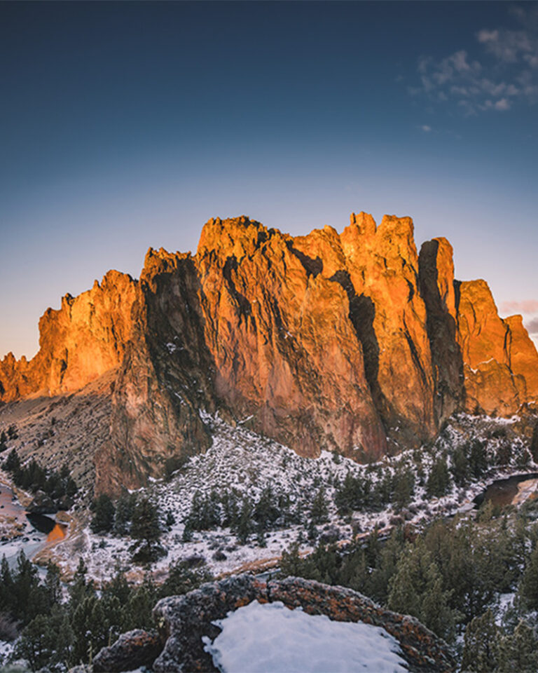
Quiz time: What’s one thing nearly half of all Bend visitors do, and the most searched-for term on our website? If you said “hiking,” grab yourself a beer (incidentally, another oft-searched term).
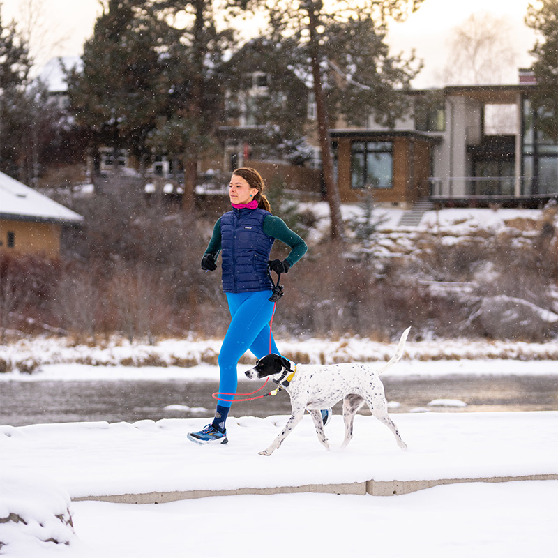
Even when it’s winter, Bend’s trails beckon. While some high-elevation hikes are off-limits this time of year, you’ll still find gobs of great spots to hoof it without snowshoes.
Here are my winter faves.
If you hear the word “park” and picture a concrete slab with slides and a jungle gym, get in your car and drive directly to Sawyer Park. Stretching over nearly 54 acres, this scenic community space spans both sides of the Deschutes River.
You’ll find tons of trails to choose from, with connections to First Street Rapids Park, Sawyer Uplands Neighborhood Park, and Archie Briggs Natural Area. Stick close to the river for a shorter stretch of trail, or head uphill for one with a birds-eye view of the river and forest. Speaking of birds, this is a great spot for birdwatching, and more than 140 species of them have been spotted in the park. Watch for bald eagles, ospreys, Lesser Goldfinches, Violet-green Swallows, Ruby-crowned Kingletsk, and Great Blue Herons. Even when it’s snowy, the trails get tramped down quickly enough to make for fairly simple hiking out here.
My love of this sprawling 29,000-acre desert landscape a few miles east of Bend is well-documented on this blog, but I love the Oregon Badlands Wilderness best of all in wintertime.
Snow is sparse, and there are dozens of trailheads offering access to stunning desert canyons, ancient junipers, craggy basalt cliffs, massive lava flows, and wildlife ranging from falcons to packrats to deer.
The vastness of the area means it’s a good idea to study a map before heading out so you know where you’re going. My personal faves are the Dry River Trail, the Larry Chitwood Trail, and the Ancient Juniper Trail loop combined with an in-and-out hike to Flatiron Rock.
Bring plenty of water, and don’t expect any facilities like restrooms or trash cans. It’s rustic out there, which is exactly what makes it special.
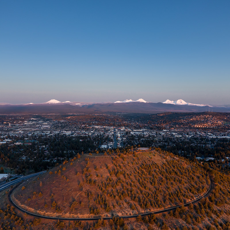
Why is Pilot Butte the perfect hike in wintertime?
For starters, the paved road to the top is closed to cars in winter months, so you’ve got multiple traffic-free trails to the top of this 500-foot extinct volcano smack dab in the center of town.
The 360-degree views you’ll get from the top make it a fab place to catch sunrises and sunsets, not to mention orienting yourself to the area. You’ll see the Cascade Mountains to the west, the Badlands to the East, and prominent landmarks like Downtown Bend and the Old Mill District along the Deschutes River.
Watch for icy patches in the shade, and tread carefully if you choose to go when the light’s dim.
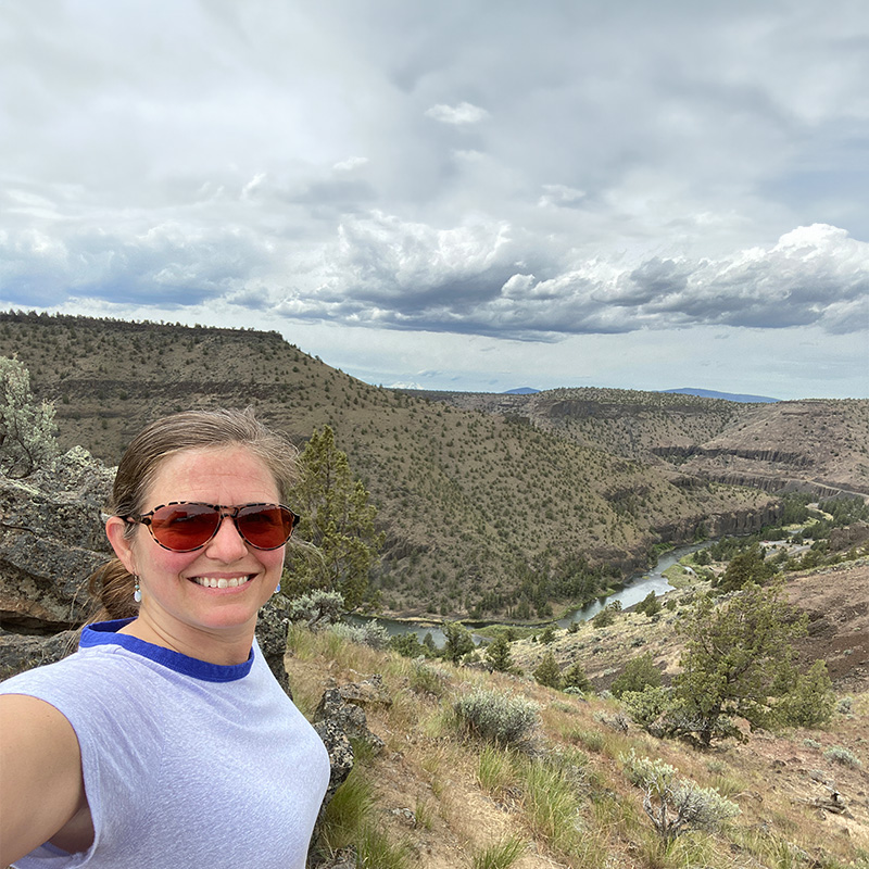
The Crooked River Gorge boasts some of the most magical landscapes you’ll see in Central Oregon, and the top of Chimney Rock makes an excellent vantage-point to scope them out.
It’s a 2.7-mile out-and-back hike with breathtaking views from the top. The elevation gain is made tolerable by a series of switchbacks that ease you up rugged ridges. Stop often for water, and remember to bring your own (in a reusable water bottle, of course) since there aren’t facilities at the trailhead.
Leave lots of time for snapping photos at the top, and don’t forget to nab some pics from the bottom, too. The rock formations out here are a sight to behold, and Chimney Rock itself looks lovely from all angles.
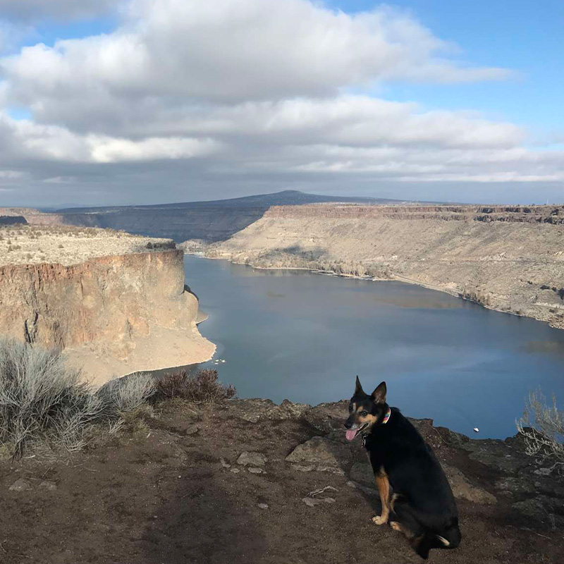
Not to be confused with Tamolitch, the Tam-a-lau Trail is opposite both in the direction you drive to get there and the scenery you’ll see along the trail.
Located in Cove Palisades State Park, the trail involves a mile-long ascent up to a lava plateau, followed by a four-mile loop hike studded with jaw-dropping views all the way around the rim. You’ll see both the Crooked River and Deschutes River arms of Lake Billy Chinook, along with killer views of The Island, a smaller plateau that’s off-limits to hikers.
Since this place is packed in summer months, winter is the best time to enjoy plenty of quiet and solitude that you can’t get at the peak of jet boat season. Keep in mind that the one-mile ascent is pretty steep, and can be icy in wintertime. It’s not a great pick for years with heavy snow, but it’s been perfect in early-2019 with our relatively low snowpack.
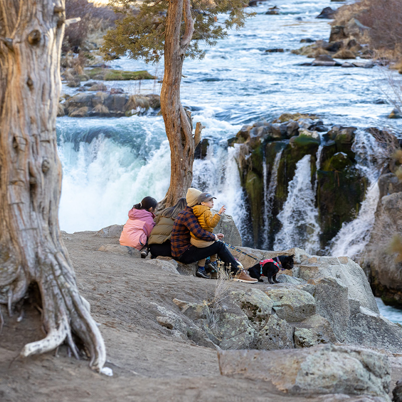
A great pick for waterfall chasers, Steelhead Falls is only about a half-mile from the trailhead, but what a half-mile it is. The canyon walls are lined with colorful grooves that show the erosion of time and water, and the splash of water soothes your soul.
A relatively easy hike, there are a couple steep sections that can be slick in icy conditions. Take your time, and plan this adventure for a snow-free day.
You might also consider combining this one with a visit to Smith Rock State Park.

Smith Rock State Park is regarded as one of the seven wonders of Oregon, and for good reason. Towering basalt cliffs, gorgeous river views, and jaw-dropping landscapes will leave you gaping in wonder at every turn.
There are lots of spots to hike around this 651-acre state park, so choose whatever fits your schedule and skill level. If you want to keep it simple, opt for an easy 2.5-mile stroll on flat ground along the River Trail from the park bridge to Monkey Face (which really does look like a monkey’s face!)
If you’re feeling more ambitious, hike up the Misery Ridge Trail (elevation 3,360 feet) for killer views of the entire Central Oregon Cascade mountain range.
And no matter which hike or climb you choose, make sure to stop along the way and stare at the river for a few minutes. Odds are good you’ll be rewarded by views of river otters frolicking in the cool water.
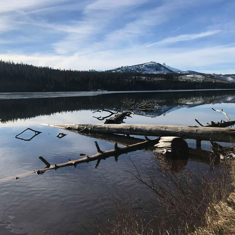
Confession: This hike is the first spot I confessed my love to the guy who’s now my husband, so it holds a special spot in my heart.
The hike around Suttle Lake is a 3.6-mile loop that’s relatively flat the whole way around. Snowier years will find the trail covered over, but low-snow years will leave mostly bare pathways along the east and north sections of trail. Be prepared for icy conditions along the south side (Yak Traks are a great idea!) and be prepared for breathtakingly beautiful scenery all the way around.
I’m partial to starting at the Lodge and hiking counter-clockwise, doing the bare sections of trail first so I’m warmed up for when I hit the slick parts. Cap off your hike with breakfast or lunch at Suttle Lake Lodge. Both lodge and trail are super dog-friendly, so this is a nice one to bring Fido along.
The Deschutes River Trail is another good option for hikers who prefer to stick close to Bend.
The main trail starts at the Meadow Camp picnic area just off Century Drive. You can access a lot of other trailheads off FS road 41, so pick your starting point and your route depending on your skill and endurance.
To keep it nice and short, try the Meadow Camp to Lava Island hike, which clocks in at just over a mile. If you’re game for a bigger hike, you can hoof it all the way from Meadow Camp to Benham Falls, passing Lava Island Falls, Aspen Camp, and Dillon Falls along the way. That one will require about 8.5 miles of hiking, so plan accordingly.
The nice thing is that you can set out from Meadow Camp and decide along the way what you feel up to. If everyone’s still feeling strong after a couple miles, keep going. If someone in your party (possibly a parent) has a temper tantrum meltdown after mile one, just head back. Easy-peasy!
No matter how far you go, you’ll be treated to splendid views of the Deschutes River and the towering ponderosas and lava rocks that line the trail. This is a pretty well-trafficked trail in summer months, so winter is a great time to experience relative quiet out there.
Full disclosure: I don’t often hike here since dogs are prohibited (understandable, since Riley Ranch is a nature reserve where wild critters roam free). When I do ditch the pups and head out here, I find myself wishing I could visit every day.
It’s possible, given the park’s proximity to the center of town. This 184-acre trail system at the northwest edge of Bend offers miles of stunning rimrock cliffs ambling along the Deschutes River. From grassy meadows to ancient junipers to pine forests, you’ll find every sort of landscape you can imagine.
Trails are well-marked and you’ll even find paved stretches to make trekking a breeze. Follow the lava flows on your quest to scope out native plant species, migratory birds, and other wildlife, plus historic sites connected to Bend’s oldest homestead.
April 17, 2024
6 minute read
March 28, 2024
7 minute read
March 26, 2024
9 minute read
March 1, 2024
8 minute read
February 9, 2024
7 minute read
January 25, 2024
7 minute read