Inspiring winter hikes in Central Oregon
December 26, 2023
10 minute readSometimes, you want a shorter hike. Something without much elevation gain that’ll have you back to your Bend hotel before your next meal.
A shorter hike doesn’t mean you have to shortchange the scenery or give up the wow factor that makes Bend hiking magical. If you’re seeking short but sweet hikes around Bend, here is a whole list of them under three miles long with minimal elevation gain and a drive time of less than 45 minutes each way.
Try one or two or six of them this fall (confirming beforehand that wildfire activity hasn’t temporarily closed your top pick) and prepare to be dazzled by scenery you won’t have to work hard to see!
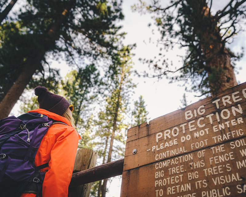
One of the shortest, sweetest hikes on this list, the Big Pine Loop (sometimes called Big Tree Loop) in LaPine State Park comes in at .7 miles round trip. Despite the short distance, it still packs the punch of bringing you up close and personal with a stately ponderosa that’s the world’s largest of its subspecies.
Follow the short, paved trail near the park entrance and make your way to the tree itself (you can’t miss it!) With bonus views of the river below, this hike makes a good pick with kids or folks with mobility challenges.
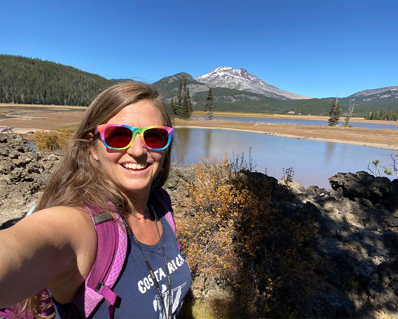
In the interest of full-disclosure, I’ll admit the road to Sparks Lake sucks. But if you endure the ruts and you visit in autumn once summer crowds die down, prepare for some of the most epic views in Central Oregon. The Ray Atkeson Loop Trail is roughly 2.6 miles with a little elevation gain, but nothing too tough. Parts of it are paved, and dogs are welcome on leash.
Hike through a lodgepole pine forest until you reach a junction. Heading right on a paved trail will take you through a fissured lava flow where you’ll get your first glimpses of South Sister and Broken Top. Stop here for photos, then keep going for a zillion more viewpoints that’ll have your jaw falling open as you make your way along the lake shore.
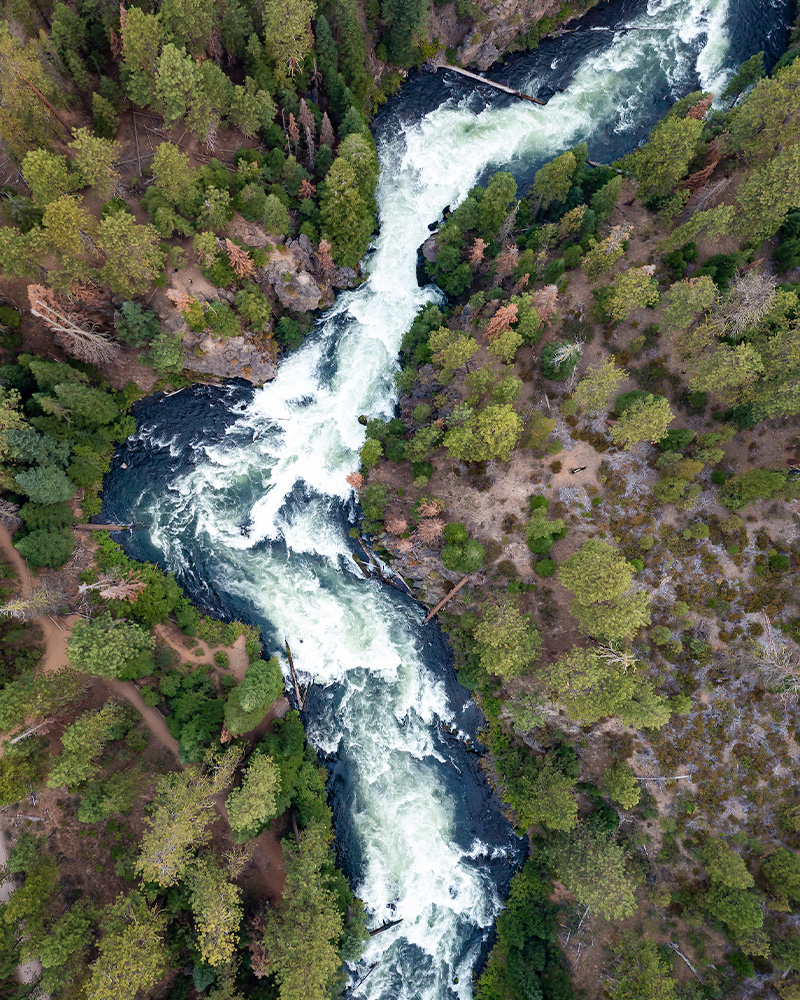
We’ve gotta have a waterfall in the mix, so let’s start with this easy out-and-back route that’s open year-round and features plenty of wildlife watching opportunities. A popular trail, the route to Benham Falls is usually lined with walkers, runners, birders, and other outdoor enthusiasts seeking a glimpse of this cascade-style waterfall with 50-feet of elevation change.
There are two routes to hike Benham falls. For the 1.9 mile out-and-back option, start on the east side of the river by the Lava Lands Visitor Center. For a shorter 1.5-mile option, try the trailhead on the west side of the river off Forest Service Road 41. Heck, why not try both and see which you like best?
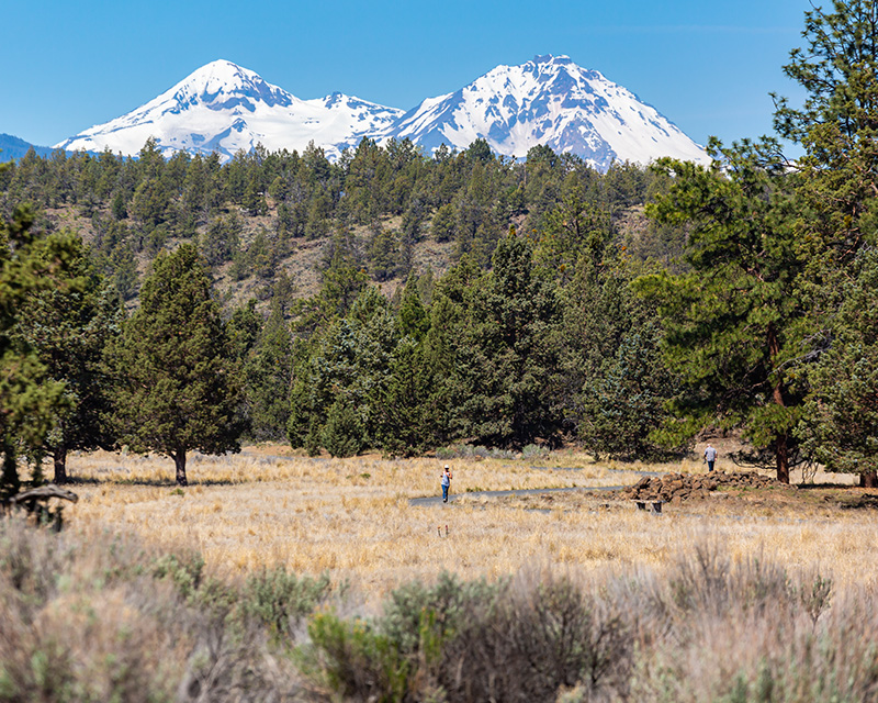
This 184-acre trail system at the northwest edge of Bend offers miles of stunning rimrock cliffs ambling along the Deschutes River. From grassy meadows to ancient junipers to pine forests, you’ll find every sort of landscape you can imagine at Riley Ranch.
Trails are well-marked and you’ll even find paved stretches to make trekking a breeze. Exploring here gives you a chance to scope out native plant species, migratory birds, and other wildlife, plus historic sites connected to Bend’s oldest homestead.
There’s a 1.57 mile compacted gravel path that flows in a figure-eight loop above the canyon through open meadows, unique lava flows, and the cliff’s edge above the river. You can also do either of the figure-eight’s loops by themselves, including the Juniper Loop (the .7 mile one just off the parking lot) or the .9 mile Sage Flats Loop. For a slightly longer stretch with a bit of elevation, try Robin’s Run down the canyon rim, which links to the 1.25 mile Canyon Loop.
Since this is a nature reserve, dogs are not allowed anywhere on the property. Leave Fido at home for this one, and enjoy the wildlife without scaring it half to death.
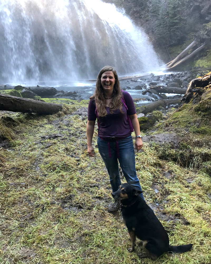
Want a glimpse of Whychus Canyon without the steep trek down into it? Whychus Creek Overlook is the way to go, with a simple .9 mile loop that takes about 20 minutes to complete. It’s a trail that’s open year-round, with plenty of birds and wildlife along the way.
A gravel path takes you to lookout points where you’ll catch stunning views of both Broken Top and South Sister. Getting there takes just a quick jaunt from downtown Sisters down Elm Street, which becomes Three Creek Road (aka Forest Service Road 16…er, it’s easier than it sounds!)
The out-and-back South Trail is the easier one that winds through the forest before reaching the overlook, but if you’re wanting more challenge, the North Trail runs in a loop and offers sustained hill climbs and a longer distance.

I’m not exaggerating when I say I hike the Pine Nursery Park Trail every single day. What can I say? It’s close to my house and features 4.5 miles of paved trails interwoven past soccer fields, pickleball courts, a playground, a fishing pond, a disc golf course, and even the 18-acre Bob Wenger Memorial Off-Leash Area.
But back to the trails. The 1.25 mile paved loop trail is the one you’ll likely follow if you hop on the paved path and just start walking. The route you take kinda depends on where you park, which can be near the entrance to the pickleball courts and off-leash area, or on the south end by the soccer fields. Either way, it’s an easy trek and ADA-accessible, with almost no elevation gain. Even kiddos on bikes or scooters can tag along for this one. Watch for owls and jackrabbits, not to mention some pretty epic sunsets at the end of the day. Desert landscapes are some of my favorites around Bend, and you’ll find those in abundance out here.

Want a paved path with plenty of views of Central Oregon’s volcanic history? The Trail of Molten Land is the route for you! Looping through ancient basalt lava flows, it carries you just over a mile to the base of Lava Butte.
About a third of the trail is a newly-reconstructed section that’s universally accessible, while older sections have a bit more grade. Interpretive signs along the way tell the story of Lava Butte’s eruption and the geology of the region. It’s part of the Newberry National Volcanic Monument, which I’ll admit is one of my happiest happy places in all of Central Oregon.

Parking and hiking around this stunning, glass-green lake can be bonkers in summertime when everyone’s scrambling to paddle or use the area as a starting point to climb South Sister. But when fall comes and the crowds die down, Devil’s Lake makes the perfect little 1.6 mile out-and-back hike. Bonus: The bugs that plague its shores in late summer are mostly gone by mid-September.
The lake is the superstar here, with spellbindingly bright color around every bend in the trail. There’s a little elevation gain and some rocky terrain as you hug the lake shore, but take your time and enjoy it as a leisurely stroll with plenty of photo ops. Pay attention to rules for permits and parking passes, depending on when you go.
Most of all, make sure you’ve got lots of battery life on your phone for snapping photos. Trust me, you’ll take a ton.

One of Bend’s most beloved gems, Shevlin Park boasts miles of trails through old-growth forest and sage-covered desert spanning nearly 1,000 acres.
While the popular six-mile loop trail along the canyon rim draws the most crowds, the shorter Tumalo Creek Trail clocks in at 2.5 miles and follows the creek upstream from the park entrance to the park’s southern end. This one’s especially lovely once autumn’s chill turns its aspens to bright beacons of gold glinting on ripples in Tumalo Creek.
Dogs must be leashed, and the rule is strictly enforced. The park’s proximity to Downtown Bend means you’ll be back on the Bend Ale Trail before the mud on your hiking boots dries.

With so many trails running alongside the Deschutes River, it’s tough to know what folks are talking about when they refer to hiking the Deschutes River Trail. For the purposes of this post, I’m pointing to the section within the Old Mill District where paved pathways make much of the trek ADA accessible.
Between Farewell Bend Park, McKay Park, and the Bend Whitewater Park, the trail criss-crosses the river at several bridge points, so you can stroll as little or as much as you want and make your own loop. Stick to the Old Mill District side of the river if you want to browse shops and restaurants to break up the hike, or explore the opposite side further upstream to get a bit more dust on your hiking boots.
These trails are great for walking, hiking, or cycling, and perfect for kids on bikes or scooters. Pick up a free birdwatching guide in the Old Mill District so you know which feathered friends share the trail with you.
If you’ve been skittish about visiting Todd Lake since the Central Cascade Wilderness Permit System launched, this will put your mind at ease: You don’t need a permit if you’re tackling the simple, 1.7 mile loop around the lake, as this trail doesn’t enter the Three Sisters Wilderness.You’ll still need a Northwest Forest Pass to park here, and permits are required if you’re taking trail 34 up toward Broken Top. But to do the loop hike, you won’t need to mess with reservation systems or planning ahead for permits.
That keeps it nice and simple, as does the trail itself. It’s fairly flat, easy to follow, and offers excellent views of wildlife, water, and surrounding mountains. It can get buggy in the summer, so fall’s a great time to visit. One of my most magical Bend memories is hiking around this lake the moment the first snow began falling one November five years ago. Bring layers just in case, but you’ll be back at your car in about half an hour, even if you encounter changing weather.

One of Central Oregon’s most underrated waterfalls (in my humble opinion), Cline Falls features a 1.2 mile out-and-back trail not far from Redmond.
It might take a sec to get oriented when you visit for the first time, as you park at the Cline Falls State Scenic Viewpoint on the opposite side of the highway, then walk back toward the road and go under a bridge. I promise it’s simpler than it sounds, and the hike itself is a cinch once you hop on the gravel pathway that’s stroller-friendly and wheelchair accessible in an all-terrain chair.
But back to what you’re getting from this hike. From unique rock formations to the turbulent splash of the falls themselves, this hike offers serious eye candy for those seeking waterfall views unlike those you’ll see in more forested areas. It’s rustic and desertlike and I can sit on the bank and stare at that water for hours.

December 26, 2023
10 minute read
November 17, 2023
5 minute read
November 9, 2023
9 minute read
September 12, 2023
13 minute read
September 8, 2023
6 minute read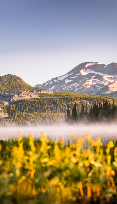
September 8, 2023
7 minute read